

Will We Ever Experience “The Big One” In North Dakota?
The most recent study by the U.S. Geological Survey showed shocking and even scary things about some parts of the country. But what about North Dakota?
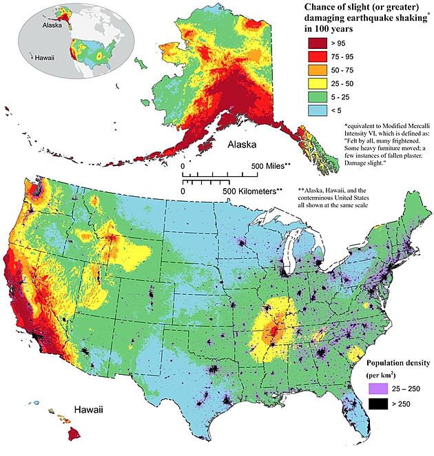
These researchers found that almost three quarters of the United States could be hit by a damaging earthquake in the next hundred years.
Over fifty scientists and engineers conducted the latest USGS National Seismic Hazard Model (NSHM). Based on seismic studies, old geologic data, and the newest ways to collect data, this model was used to make a color-coded picture that shows exactly where damaging earthquakes are most likely to happen.
Using the newest tools and technology, the group found almost 500 faults that had not been known about before and could cause a damaging earthquake. This shows how earthquake study is changing over time.
“This was a massive, multi-year collaborative effort between federal, state and local governments and the private sector,” said Mark Petersen, USGS geophysicist and lead author of the study. “The new seismic hazard model represents a touchstone achievement for enhancing public safety.”
What Were The Key Findings Of The Latest USGS Seismic Hazard Model?
- Risk to People: Nearly 75% of the U.S. could experience potentially damaging earthquakes and intense ground shaking, putting hundreds of millions of people at risk.
- Widespread Hazard: 37 U.S. states have experienced earthquakes exceeding magnitude 5 during the last 200 years, highlighting a long history of seismic activity across this country.
- Structural Implications: The updated model will inform the future of building and structural design, offering critical insights for architects, engineers, and policymakers on how structures are planned and constructed across the U.S.
- Not a Prediction: No one can predict earthquakes. However, by investigating faults and past quakes, scientists can better assess the likelihood of future earthquakes and how intense their shaking might be.

So how likely are we to have a significant earthquake in North Dakota?
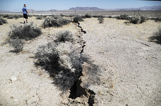
When salt beds below dissolve, layers of solid rock may fall into the empty spaces that are left behind. This can cause small tremors. The northwest of North Dakota is made up of thick, huge salt layers that are between 4,000 and 12,000 feet deep.
Since salt is a mineral that dissolves easily in water, it is geologically fragile. This means that it can move and change shape when a thick layer of sediment sits on top of it. When the salt moves through layers on top of them, they become less stable. It's possible for these layers to sink slowly or all at once, which would cause a small, shallow earthquake.
There aren't many seismograph spots in the Midwest because the ground there is very stable. The states of North Dakota and Minnesota do not have seismographs. The US and the former USSR governments built a seismograph on the northern edge of the Black Hills to keep an eye on nuclear tests. The seismograph is now being run by the U.S. Geological Survey.
One station is run by the Canadian federal government in Flin Flon, Manitoba, and the other is run by the University of Manitoba in Winnipeg. Pinawa, Manitoba, is about 120 kilometers east of Winnipeg. It is home to an industrial study seismograph.
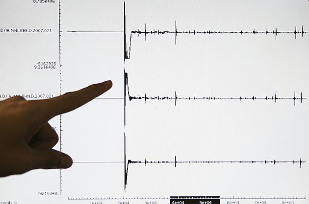
Seismographs all over the world can record quakes that are at least 4.5 on the Richter scale. Less powerful shocks go away before their seismic waves can be picked up by tools far away. If there was an earthquake in central North Dakota with a magnitude of 3.3 or higher, it would only be picked up by the seismograph sites that are closest to the event.
It's possible that other small known earthquakes have had epicenters in North Dakota, but the 1968 Huff earthquake is the only one that has an instrumentally confirmed epicenter in the state. In fact, the network of seismographs in the Upper Midwest that record these small tremors has only been in place since the early 1960s.
Also, people who are in a good position usually feel tremors that are 3.0 on the Richter scale or less. Simply put, instrumentally confirmed records might not show the real number of small tremors happening in the state.
Because of its location, North Dakota has a very low chance of having an earthquake. Every once in a while, small earthquakes may shake the state, but they generally don't do much damage.
This doesn't mean we will never experience one; it also doesn't mean that we should rush out to purchase earthquake insurance.
15 Big Brands Closing Minnesota + Wisconsin Stores In 2024
Gallery Credit: Lauren Wells
More From KEYZ AM 660